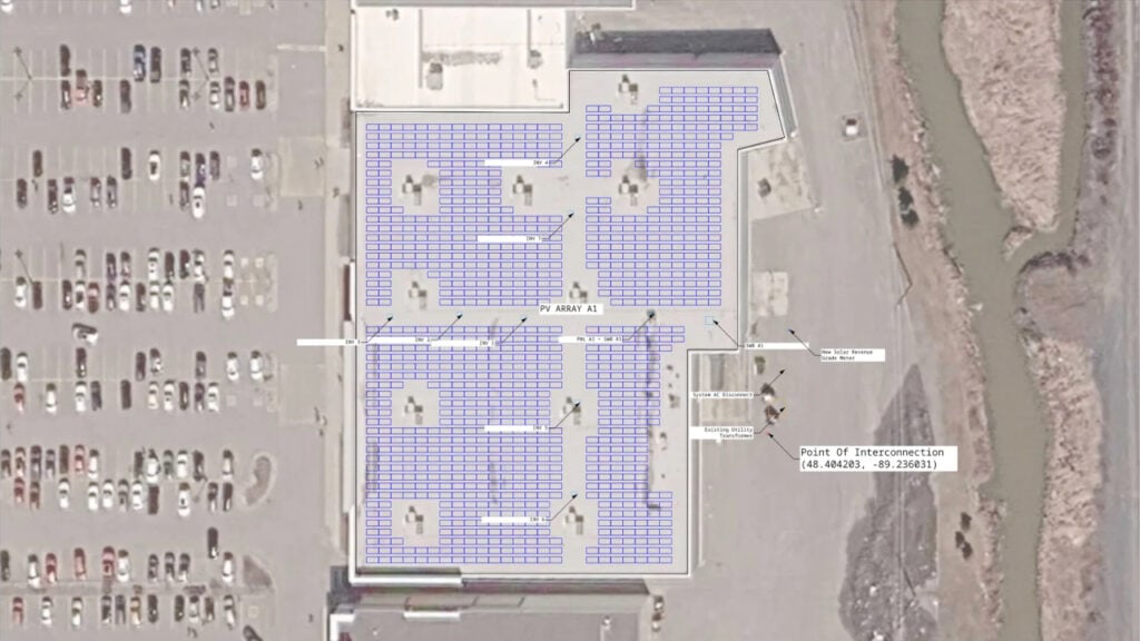
Chicago-based Solesca, creators of design software for commercial & industrial (C&I) and community solar projects, has released the second version of its software, which includes the ability to map the terrain for a proposed PV installation site.
The Solesca vs platform provides detail affecting predictions around site selection and yield metrics to improve site planning and design. Developers can see how terrain might affect a layout while still evaluating a site, and Solesca’s new 3D view means teams can explore the full design on a realistic digital model of the site.
Try Premium for just $1
- Full premium access for the first month at only $1
- Converts to an annual rate after 30 days unless cancelled
- Cancel anytime during the trial period
Premium Benefits
- Expert industry analysis and interviews
- Digital access to PV Tech Power journal
- Exclusive event discounts
Or get the full Premium subscription right away
Or continue reading this article for free
The company notes that terrain modelling is typically undertaken in the highly-complex AutoCAD software, which requires significant training to use effectively, and that use of AutoCAD modelling often takes place late in a design proposal, after site selection and the running of early numbers.
The new software enables users to assess the effects of terrain on a proposed site and its installation early in the design process and can avoid unforeseen costs and loss of resource investment.
“A lot of the expensive surprises on solar projects come from decisions made early with incomplete information,” said Sam Schierloh, CEO and co-founder of Solesca. “[Solesca v2] gives developers a much clearer picture of a site before they commit to it, which means less time and money spent on projects that were never going to work.”
Solesca comes in ‘core’ and ‘pro’ tiers, with the latter version offering additional simulation depth. A terrain tracking feature is available as a paid add-on, while 3D views let users see a site design from multiple angles and at different times of the day so potential spot shading issues are more easily apparent.
The update to v2 also includes bankable energy simulation, which integrates DNV’s SolarFarmer and NREL’s System Advisor Model (SAM) in the platform, making Solecsca’s software the only pre-CAD software to combine design iteration modelling with bankable yield calculations depending on module siting, mount type and location.
The software is now live for all Solesca users, and customers can request a demonstration of the software and its new features via the company’s website.
The launch follows Norway’s Glint Solar unveiling its own software for land parcel searches and mapping across several US states (to date, Illinois, Maryland, New York, Pennsylvania, Texas and Virginia) with other states in the US, plus France, Germany and the rest of Europe to be added to Glint’s database in the future.
Speaking to PV Tech Premium, Glint Solar CEO Simen Fure Jørgensen said that many PV developers had developed a scattershot approach to site selection, with many more grid applications made than were realistic, in the hope of winning a few permits.
“[Developers] are starting way too many projects that maybe never had a chance to live,” he said. “It’s just as likely they weren’t aware of every single fact on the ground.”
The use of software platforms with access to public land registries, geographical information and grid connection data, plus the latest generation of 3D modelling software tuned to solar power installations, can help more projects reach production with a minimum of wasted resources.