Next week Nextracker is collaborating with PV Tech to host a webinar on shade modelling for utility-scale solar PV projects, discussing tracker shade loss and its potential remedies. The webinar is to be held at 09:00 PT / 18:00 CEST on 19 August 2021. You can register for the webinar here.
Row-to-row shading resulting from variability in terrain or construction tolerance is a particularly pernicious source of loss in large-scale solar power plants. Why? Because it is not only possible to model terrain shade loss using industry-standard software, but also a lion’s share of these losses can be recovered using advanced system design and control strategies.
Unlock unlimited access for 12 whole months of distinctive global analysis
Photovoltaics International is now included.
- Regular insight and analysis of the industry’s biggest developments
- In-depth interviews with the industry’s leading figures
- Unlimited digital access to the PV Tech Power journal catalogue
- Unlimited digital access to the Photovoltaics International journal catalogue
- Access to more than 1,000 technical papers
- Discounts on Solar Media’s portfolio of events, in-person and virtual
Not so long ago, industry stakeholders could target vast expanses of flat sunny land for solar project development, whether in the Mojave Desert or the San Luis Valley of Colorado. Since these pioneering sites were largely devoid of complex terrain, performance models could characterise these sites by assuming standard backtracking on a flat surface. These basic assumptions no longer serve the industry well.
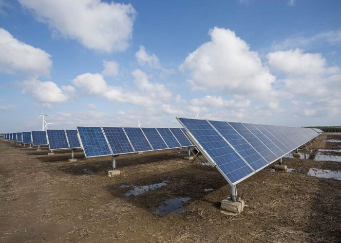
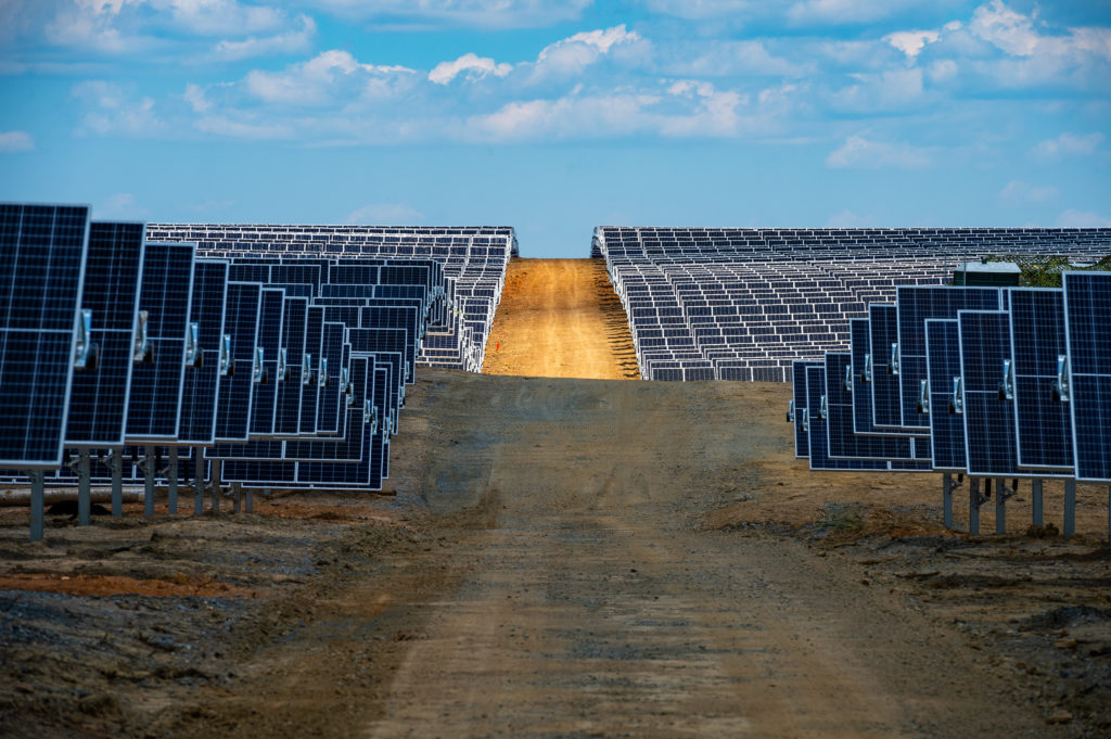
Today, utility-scale solar increasingly shows up on sites with complex terrain — places that would have perhaps seemed unsuitable for solar development only five years ago. Moreover, ‘perfectly flat’ sites have always been more of a myth than a reality. Scanning rows of driven piers across a solar construction site, pier heights vary noticeably, even in adjacent rows on relatively flat sites. Even in the best of circumstances, some terrain variance is inevitable, especially given the magnitude of today’s project sites.
A common, if quiet, theme at PV conferences is that fielded assets are underperforming relative to expectations and no one really knows why. One plausible explanation is that the problem lies not with the fielded asset, but rather with our expectations. Depending on your perspective, tracker terrain losses are either the elephant in the room that no one is talking about or the low-hanging fruit that no one is harvesting.
If tracker terrain loss is not accurately modelled, PVsyst production modelling simulations, and the revenue models these inform, will tend to overestimate PV plant performance. Consistently underestimating these impacts could erode investor returns and confidence. Moreover, there is little urgency or incentive to clawback avoidable system losses so long as these are consistently underestimated during project development, design and procurement.
While terrain shade loss is a real problem, the PV performance modelling community has this issue squarely in its sights. As part of the 2021 IEEE PV Specialists Conference (PVSC) proceedings, a group of performance engineers from DNV presented the results of an ongoing terrain shade loss study[1]. The authors used DNV’s SolarFarmer software to model a site in North Carolina with a 4% average southwest slope. Analysing the difference in yield between trackers on horizontal ground relative to the yield on variable terrain, the authors found a tracker terrain loss of -2%.
Recent work by engineers at Black & Veatch yielded similar results[2]. Studying a proposed PV plant in the Eastern U.S. at a site crisscrossed by wetlands with east-west slopes of around 3%, the authors modelled terrain yield loss of approximately -2.5%. Analysing the impact of a terrain-adaptive backtracking strategy, the authors concluded that it was possible to recoup a majority of the terrain shade loss.
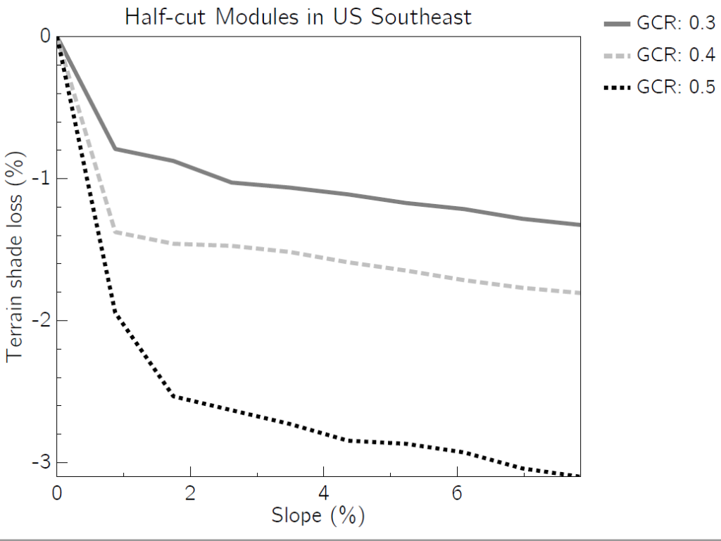
Nextracker’s own modelling results validate the rough order of magnitude of yield loss estimates associated with sloped terrain. In a location with high diffuse irradiance content, a mild 3% grade can result in annual losses ranging between 1%–2.5%, depending on ground coverage ratio (GCR), using standard backtracking. Note that we modelled these results, shown in Figure 1, using “shade tolerant” half-cut cell modules.
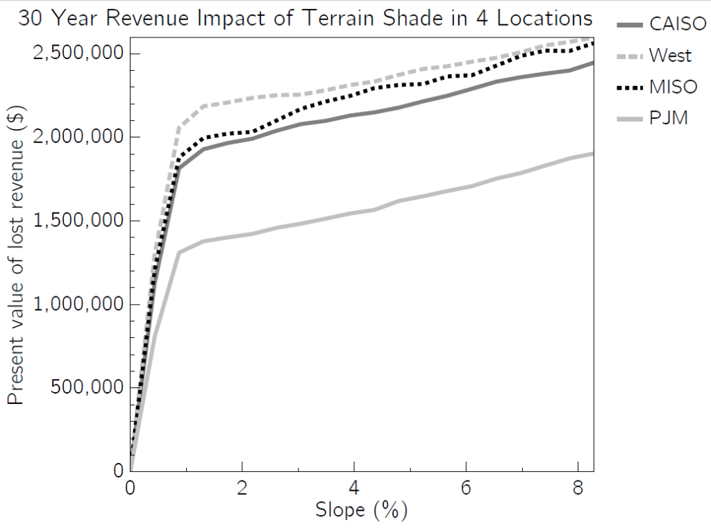
We then expanded this analysis, based on a representative 100MW single-axis tracker-mounted plant and region-specific average PPA rates, to multiple locations. As shown in Figure 2, the financial impact associated with tracker terrain shade loss is far from insignificant. Annually, the terrain shade loss is on the order of US$100,000 – 200,000. This is a big gap between expectations and reality, especially for asset owners closely tracking fleetwide project financials. Extrapolated over the life of the project, the present value of revenue loss over 30 years of operation, discounted at roughly 5%, is easily over US$2 million per 100 MW of plant capacity.
The significance of this underperformance risk merits a more disciplined approach to terrain shade loss modelling. The most recent version of the de facto industry standard performance modelling software, PVsyst 7, provides basic tracker terrain shade loss modelling capabilities for east-west slope variance. Coupled with Nextracker’s best practice guidelines for terrain modelling, engineers can import AutoCAD files of real plant layouts into PVsyst, overlay detailed topography from the USGS or on-site surveys, and estimate the impact of east-west slope variance. This additional rigour benefits all stakeholders — developers, EPCs, IEs, insurers and investors — by increasing transparency and trust in key sources of yield loss in large plants.
To recoup terrain and construction tolerance losses, project stakeholders can deploy advanced tracking algorithms, such as Nextracker’s TrueCapture technology, in fielded systems. Enabled by Nextracker’s high-speed, high-accuracy, and high-granularity tracking hardware, TrueCapture algorithms use precise site- and installation-specific information to calculate an optimised control strategy for each independent tracker row.
By minimising row-level terrain shade loss, Nextracker is able to maximise system-level yield. Nextracker also has a proprietary modelling solution, TrueSim, that not only estimates the yield benefits associated with TrueCapture, but also provides a verification process for realized gains. Modelling and mitigating terrain shade loss is only one of the many ways that Nextracker continues to optimize solar plant performance with innovative technology and data analysis.
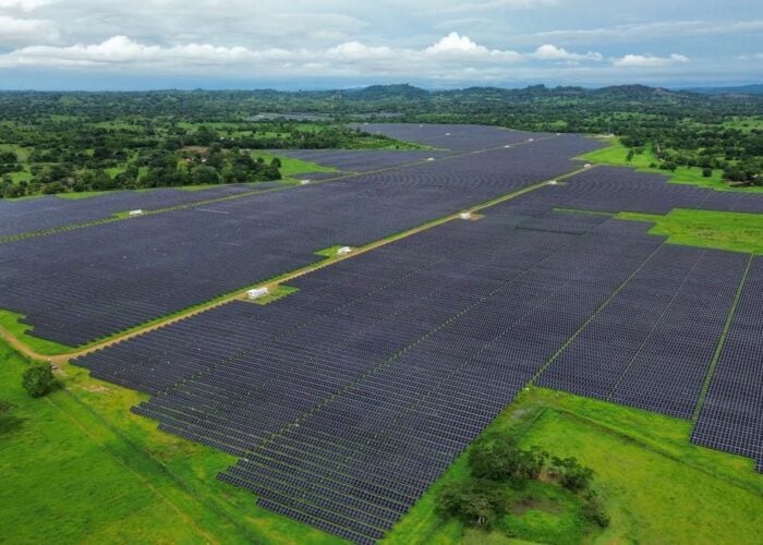
As ever-larger PV projects increase in frequency and distribution, “easy” sites for solar development are increasingly a thing of the past. Constrained sites with meaningful terrain variance are becoming the norm. The 4% average grade DNV modelled for its PVSC paper is not unusual in today’s market. If anything, it is a conservative average given that local slopes can be as high as 15%. The good news is that slope-aware backtracking mitigates shade losses associated with complex terrain.
A generic way to accomplish slope-aware backtracking is cutting and filling a site as needed to achieve a uniform slope. If piers are then driven to a uniform height relative to this graded monoplane, the result is an in-plane tracker layout. Unfortunately, perfectly in-plane tracker layouts are not a practical reality. Cutting and grading many thousands of acres is not only impractical, but may also be counterproductive in terms of soil stabilisation and habitat preservation.
Intelligently controlled, independent-row trackers are ideally suited for capturing the full yield of a solar asset and maximising its economic performance. In the real world, terrain variation is unavoidable across large utility-scale solar sites. In real life, the tops of tracker piers rarely if ever yield a perfectly planar surface. In the context of this imperfect world, the most effective way to mitigate tracker terrain loss is often the most granular.
References
[1] Mikofski, M.; Hamer, M.; Neubert, A.; Leung, M.; Parikh, A.; Kharait, R.; Tracker Terrain Loss Part Two. IEEE Photovoltaic Specialists Conference, June 2021.
[2] Kankiewicz, A.; PV plant performance challenges from near shading and complex terrain. Solar Builder Magazine, May 2021.
Authors
Aron Dobos is director of software product management at Nextracker, while Neelesh Umachandran is a performance engineer at Nextracker.

