As photovoltaic (PV) installations increase in number and scale worldwide, the need for reliability and optimum performance of PV power plants grows as well. Thus, it is essential to develop fast and efficient inspection techniques, to perform operation and maintenance (O&M) measures cost-effectively.
With the advent of commercially available unnamed aerial vehicles (UAVs), aerial inspections were developed to be one of the novel methods for O&M which seems to be a promising approach to this challenge. This article aims to discuss the advantages and challenges related to aerial inspections in large-scale PV power plants, discussing the association of UAVs with consolidated inspection methods such as visual inspection, infrared thermography (IRT) and electroluminescence (EL).
Try Premium for just $1
- Full premium access for the first month at only $1
- Converts to an annual rate after 30 days unless cancelled
- Cancel anytime during the trial period
Premium Benefits
- Expert industry analysis and interviews
- Digital access to PV Tech Power journal
- Exclusive event discounts
Or get the full Premium subscription right away
Or continue reading this article for free
Aerial inspections
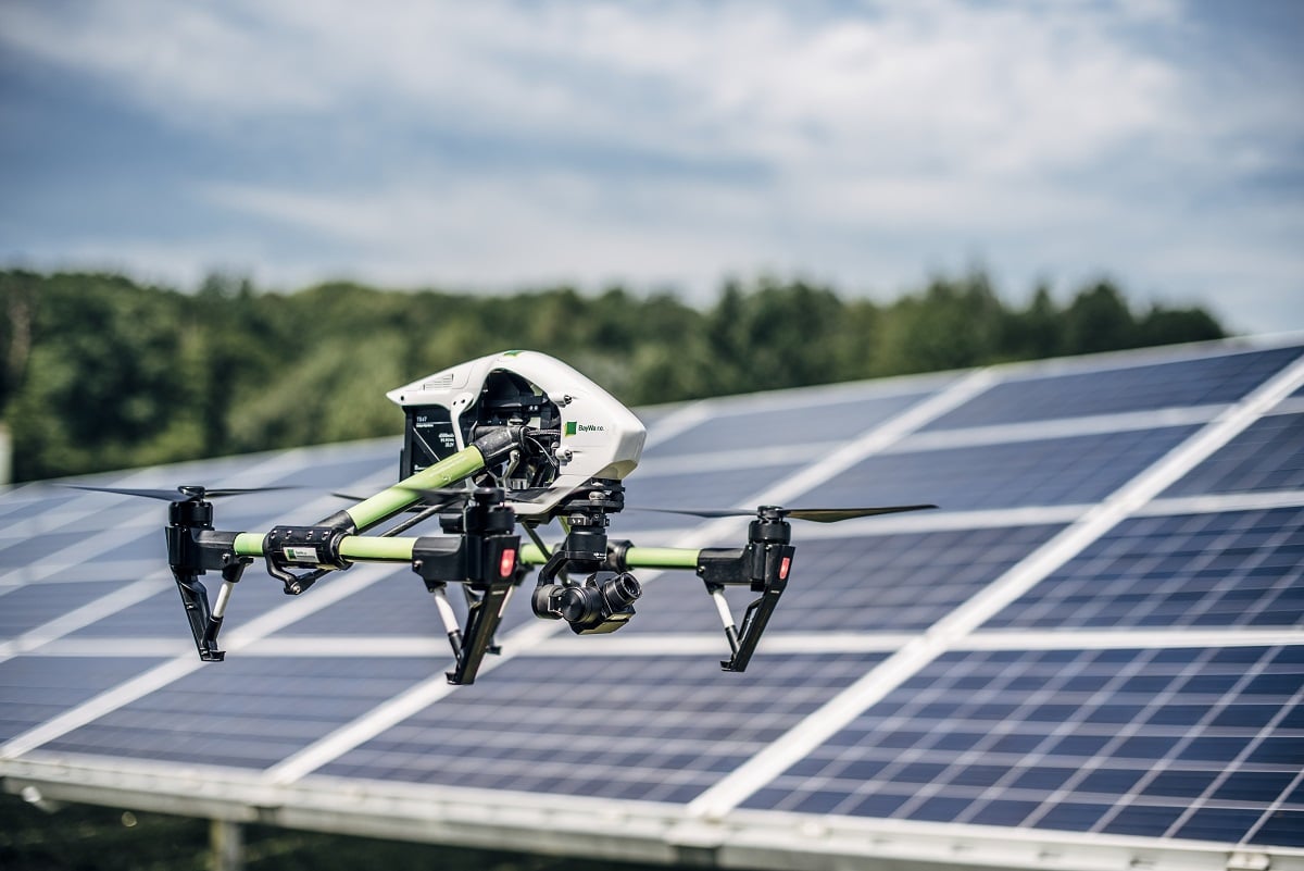
UAVs are typically small-scale aircrafts capable of remote or autonomous operation. They were originally designed for military purposes. However, recent advances and cost reductions in the field of UAV have made such technology applicable for civil operations such as disaster relief, energy and power line inspections, and environmental, forest and mine monitoring, among others. The technology has become increasingly popular, especially in the energy and agriculture sectors.
The use of UAVs to inspect large PV plants has grown significantly over the years, thanks to their superiority in field coverage, reliable imaging, quick detection, high durability, lightweight, low cost and high robustness to operate in hostile environments. They are used with RGB cameras or with cameras for infrared thermography (IRT) or electroluminescence (EL).
The widespread adoption of such devices also increased the availability of controlling and route planning software. The prior path definition of the flights enables a more stable, safe and effective inspection, mostly when precise GPS data of the site is available. Nonetheless, it does not detract from having a trained workforce for conducting the flight. The routes can vary in terms of height, direction and velocity, which depends on the quality of the UAV and the camera, the shape of the power plant, wind speeds during flight, and the goal of the inspection. The direction of the route, for example, can be parallel to the module rows or orthogonal to them, as shown in Figure 1. None of the two methods is superior to the other, but distancing between rows and power plant design factors can make one of them faster than the other. The parallel route has the advantage of facilitating the geolocation of faults, while the orthogonal route is normally more effective when flying at higher altitudes, since it covers more modules at once.
There are also attempts to determine the optimal path planning for the UAV autonomously in the literature, developing a concept of autonomous monitoring. This is a novel concept to integrate various techniques, devices, systems, and platforms to enhance the accuracy of PV monitoring, consequently improving the performance, reliability and service life of PV systems. By this approach, the entire services of PV monitoring will be provided by a single integrated system.
For this method to be implemented, first the boundary of PV plants is determined by a neural network. For this purpose, the neural network is trained by various orthophotos of PV plants. Subsequently, a static path planning algorithm is designed in order to create an optimal path for PV plant inspection. Moreover, dynamic path planning is created based on the flight situation and checks the UAV’s abilities after any specific manoeuvre, which means if the UAV cannot complete the initial path, dynamic path planning enters in the loop to create a new optimum path according to the UAV’s position and endurance.
This is an extract of an article first published in Volume 23 of PV Tech Power. The full article can be read here, or in the full digital copy of PV Tech Power 23, which can be downloaded for free here.


